

HiGEM brings together expertise from NERC, the UK academic community and the Met Office in a concerted UK effort to develop coupled climate models with increased horizontal resolutions. Increasing the horizontal resolution of coupled climate models will allow us to capture climate processes and weather systems in much greater detail.
The HiGEM high resolution coupled climate model is based on the latest climate configuration of the Met Office Hadley Centre Unified Model, HadGEM1, with the horizontal resolution increased to 1.25 x 0.83 degrees in longitude and latitude in the atmosphere and 1/3 x 1/3 degrees in the ocean.
The First Results and Publications from HiGEM
The initial publications from the HiGEM and UK Japan Climate Collaboration projects have now been submitted for peer review. The first publication to be accepted is Shaffrey et al.(2008) which describes the model and gives an overview of the first results.
There are marked improvements in HiGEM relative to the lower resolution model HadGEM. In particular the characteristics of ENSO (the El Nino Southern Oscillation) and the Tropical Pacific Ocean are much improved, primarily due to resolving Tropical Instability Waves in the Equatorial Pacific Ocean. The warm SST (Sea Surface Temperature) biases in the upwelling stratocumulus regions are reduced in HiGEM, and overall the biases in simulated SST are much less than those in HadGEM.
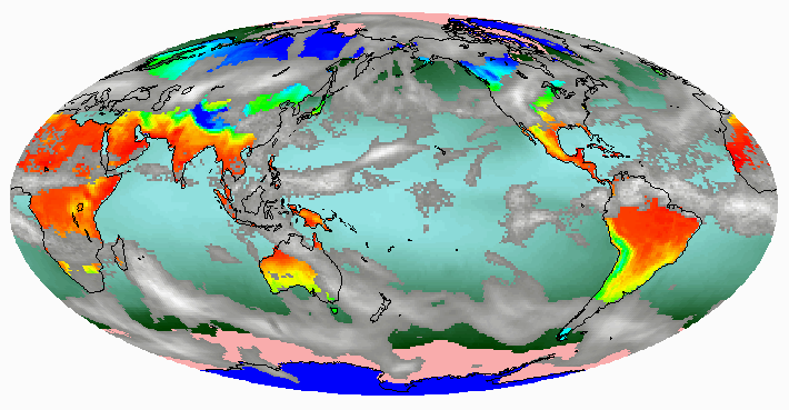 |
Snapshot of the HiGEM model, showing clouds (greyscale), surface temperatures (colours) and sea ice (pink).
Extratropical Cyclones in Climate Models
Extratropical cyclones present some of the most dangerous weather hazards in the extratropics. The extreme winds and precipitation associated with extratropical cyclones result in huge socioeconomic impacts. At the same time extratropical cyclones are one of the primary mechanisms for transporting moisture, heat and momentum in the extratropics. Correctly representing extratropical cyclones is essential for the correct simulation of climate.
The increased atmospheric resolution of HiGEM should allow extratropical cyclones to be better represented. By using a feature tracking program to and compositing we can compare the observed and modelled structures of extratropical cylones. The figure below shows that HiGEM can faithfully capture the frontal structures and spatial patterns of the strongest storms seen in the ERA-40 observational reanalysis.
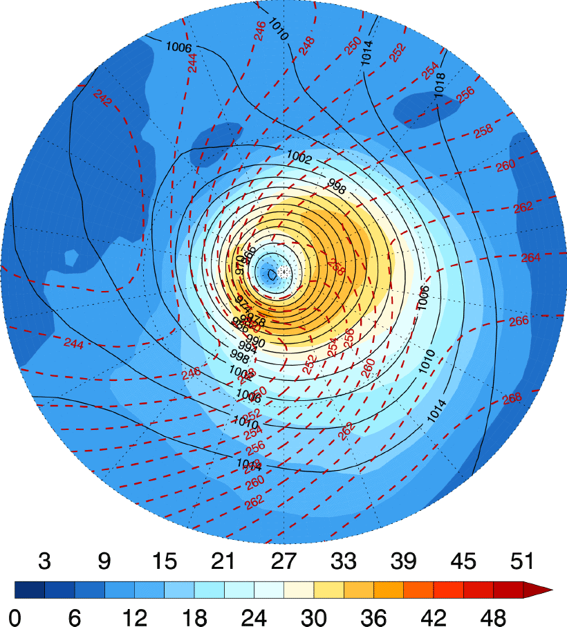
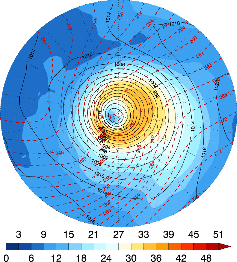
Composite structures of the 50 most extreme wintertime extratropical cyclones in the North Hemisphere from left) the ERA-40 observational reanalysis and right) 30 years of HiGEM. Black lines are isobars, red lines are mean tempertaure in the lower troposphere and colours are windspeeds.
Tropical Instability Waves
Tropical Instability Waves are shear instabilities that can be seen growing and propagating in the Equatorial Pacific Ocean. Recent satellite observations show that the tropical atmosphere couples with the SST signatures of these small scale oceanic features. High resolution in both the ocean and the atmosphere allows HiGEM to realistically capture this small scale coupling. The figure on the right shows that this coupling cannot be captured by the lower resolution HadGEM.
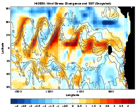
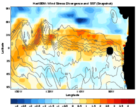
Snapshots from the Tropical Pacific of left) HiGEM and right) HadGEM showing Tropical Instability Waves. The colours are the windstress divergence, indicating that the atmosphere is coupling with the oceanic TIWs.